Friday 2 November 2012

Seaburn to South Shields - 27 October 2012 - 8 Miles on foot

Click to see the pictures


An early rise and a drive through the dark early morning and I was at Tamworth Station in good time to catch the 0646 to Newcastle.  The train was quiet and the journey uneventful apart from chatting to some fellow travellers who were headed for a shopping trip in York.  I shuddered at their adventure for the day just as much as I am sure they shuddered at mine.  The train was punctual into Newcastle and I quickly made my way into the Metro system for the next part of my journey.

The fare system on the Metro system is the most impenetrable anywhere I have come across, there are no ticket offices, the ticket machines do not give change and it is the hardest thing in the world to buy the correct ticket unless aided by an expert.  Fortunately, help was at hand in the form of a station assistant who took pity on me, advised on the best ticket and personally dispensed change as the change machine was broken.  On the journey, I discovered the necessity of buying the right ticket when two ticket inspectors boarded my carriage at an intermediate stop and shouted, "tickets ready for inspection".  They rapidly progressed through the train until they came across one man who did not have a ticket.  He was dragged off at the next stop to await a fate I can only imagine!

Having walked the dreary mile between the seafront and Seaburn Station on a previous occasion, I decided to give it a miss and caught the bus instead, arriving at Seaburn Lighthouse at 1050.
Roker Lighthouse from Seaburn
On arrival at the seafront, I was greeted with some light hail and a fresh wind that blew from the direction in which I was to travel.  The sea was choppy and the sun shone for most of the time, making for some atmospheric pictures.  Having donned my warm hat and gloves I set off northwards along the well maintained coast path.  The path ran parallel to the road, but a respectful distance apart for almost the whole of the walk.  There were a number of other people around, mainly dog walkers and a few other lost souls.
Lost souls?
Whitburn (1135 - 1.5 miles) is a post war housing development over which towers what appears to be a working windmill complete with sails.  From here the route crosses broad grassy meadows along low cliffs with many stacks and sea arches standing above the shallow water.  The way passed some, apparently and hopefully, disused shooting ranges to Souter Lighthouse (1206 - 3.1 miles).  Here I took a rare opportunity, on my coast walks, to visit a National Trust property, Souter Lighthouse.
Souter Lighthouse
Souter Lighthouse has the distinction of being the first in the country to be powered by electricity.  Following a general description of the functions of the stand-by generator and the compressors required to power the massive fog horns, I made my way to the simple two up - two down accommodation for a lighthouse keeper and his family.  These rooms were furnished with period furniture and contained appropriate nautical touches in the pictures on the walls and clothing displayed in the bedrooms.  A short climb up the tower and I was back into the cold for the final part of my walk.
Marsden Lime Kilns
In the mid 1800's, a large village was built in the area around the lighthouse to house the workers at the nearby limestone quarry and lime kilns.  In the 1960's, all of the building were torn down and all that now remains is a broad stretch of grass and the ruins of the lime kilns.  The route now remained close to the road until, at Marsden (1250 - 4.1 miles), the green area broadened out again into "The Leas" and the path meandered along the coast and past the massive Marsden Rock.  The rock was, until recently, a large sea arch and it is a mere shadow of its former self.  For some reason, Marsden Rock is a favourite spot for people in the area to commit suicide, as evidenced by the enticing adverts from the Samaritans.
Marsden Rock
The path now descended to the sand strewn promenade that led towards the mouth of the Tyne, past the obligatory amusement park doing meagre business with the brave souls who had taken the trouble to brave the elements.  Having reached the Tyne (1355 - 7.1 miles), the were a few delights to amuse me - dancing lady sculptures, moored fishing boats and some tasteful waterside apartment developments - before arriving in South Shields (1420 - 8.4 miles) which could be almost anywhere in the UK.
Colmans Fish and Chips
Colmans Restaurant came highly recommended and they did not disappoint. The fish and chips were beautifully cooked and service was both friendly and efficient.  I grabbed a coffee in the local Wetherspoons pub (so I could say I had been there!) before catching the Metro back to Newcastle.  I tried and failed to talk myself onto an earlier train than the one I was booked on, so took myself to a nearby pub and enjoyed a slow pint before boarding the 1835.  Despite delays, I managed to make my connection ay Derby and was home for 2230.

Next trip (and last this year) - 17 November - Battesbridge to Burnham on Crouch - 14 miles by bike

Thursday 1 November 2012

Filey to Bridlington (18 miles) and Bridlington to Hornsea (13 miles) - Summer 2000

See the pictures


Yet another retrospective blog as I wait to travel to the North East on 27 October.  Again the recollection is a little sketchy, but the route and the main points of interest are still clear in my mind.

I travelled by train to Filey, changing at York and Seamer.  The journey was uneventful except for a rather choppy ride on a Pacer multiple unit between York and Seamer.  On arrival at Filey, I spent a few minutes revisiting some of the places I knew as a child when we came here as a family almost every year during the 1940's and early 50's. The most significant of these was the miniature golf course, the scene of my most serious misdemeanour at the tender age of seven.  Since I was not deemed old enough to play by may parents. I was given the job of "caddy" which didn't please me one little bit.  When the rest of the family had tee'd off, I would hang behind and "modify" the course by pointing the marker arrow to a different hole.  This seemed to go fine until we strarted to hear arguments behind us as the modified course had its effect and the family was forced to retreat from the course without finishing the round!
Crime scene
Fortunately nobody recognised my from that occasion, so I was soon walking along the sands towards Flamborough Head.  On my way, I passed the now ruined remains of the Butlin's Holiday Camp which used to disgorge holidaymakers into the town pedalling garishly painted tricycles.  At the end of the beach as the limestone Flamborough Cliffs started there was a flight of steep steps cut into the rock / earth which led to the cliff top path.  The steps may or may not still be there - please check first!
Flamborough Head from Filey

There followed a very enjoyable cliff top walk around the edge of Flamborough Head.  At the very high Bempton Cliffs, I could see all kinds of seabirds wheeling around, taking off and landing on their precarious nests.  I then passed the ancient Danes Dyke. walked high above the tiny harbour at North Landing and arrived at the lighthouse and radio installations at Flamborough head itself.
Bempton Cliffs

The walk took me around the cliff past South Landing and the other end of Danes Dyke.  Finally, there was a gentle descent past Sewerby Hall and into Bridlington.  I made my way to my B&B for the night and turned in after a supper of fish and chips eaten by the harbourside.
Bridlington Harbour

The next day, I set off along the sands early after breakfast, passing a small group of beach campers.  The whole of this part of the trip was along the sands, except for the occasional excursion to overcome the monotony of seeing low, almost unbroken  earth cliffs to my right, with the calm sea to my left.  I passed Ulrome, the scene of many holidays in the 1940's the caravan site where we stayed seemed much smaller than before, due to cliff erosion.
Ulrome

Eventually, after a long beach walk, I arrived at Hornsea and caught a bus back to Bridlington, followed by the train home.

Monday 15 October 2012

Folkestone to Dover - 29 September 2012 - 8 Miles on foot

I had previously cycled between Folkestone and Dover in 2009 but felt I could gain more by repeating the the journey on foot by tracing the Saxon Shore Way which ran close to the cliff edge offering views of the sea and the prospect of visiting defensive sites from WW2.  Virgin Trains were offering return tickets for £16 so I needed no more persuasion to embark on this, my latest adventure.
The Leas

The journey to Folkestone was swift and efficient.  I left Birmingham International at 6:40 in the morning, dashed from Euston to St Pancras and caught the high speed "Javelin" train, arriving in Folkestone at 9:15.  From the station, I made straight for the broad stretch of green at the top of the cliff known as "The Leas".  It was cool, but the sun was shining, as it did throughout my walk.
Railway arch to the harbour

A short meander around the old streets of the upper town, listening to the sound of the bells of St Mary and St Eanswythe and I passed under the low railway bridge that once served the boat-train service, now long gone.  I passed under the bridge to the Quay (0945 - 1 mile), lined with attractive buildings but not at all commercialised.  The only concession to the tourists was a seafood stall.  The large harbour itself was empty except for a few leisure craft riding at anchor.
Copt Point
Moving along the Quay, the headland of Copt Point came into view which was the target of the next part of the walk - or rather the Martello tower that stands above the point.  A pleasant walk along the sunny promenade, up a few flights of steps, a walk along a green expanse and I reached the aforesaid tower, white painted with some signs of graffiti.  Near the tower was a sign informing me that I was standing on the remains of a Roman villa, much of which has now been lost to the sea.
Villa below!
As I climbed, I gained extensive views of both Folkestone to the west and the coastline towards Abbot's Cliff on my intended route.  At the top of Dover Hill, a footpath diversion took me away from the edge of the cliff and along the Old Dover Road until I came to the Battle of Britain Memorial at Capel le Ferne (1050 - 3 miles).  I took a few minutes to admire and photograph the Spitfire and Hurricane aircraft and the memorial itself, before moving on along the cliff top path.
Hurricane at Capel Ferne
After a few yards, a steep downward slope followed by an equally steep climb took me past some houses and back onto the "Old Dover Road" - a quieter section, this time.  The road soon gave way to hill top path again and I climbed my way up to the top of Abbots Cliff (1130 - 4.4 Miles).  Here the remains of World War 2 were much in evidence - gun emplacements, an acoustic mirror, a shooting range and various other emplacements.
Acoustic Mirror
A feature of this walk was the presence of a number of natural "tunnels" over the path formed from gorse and forms of undergowths.  They were dome shaped and blocked out much of the light as one progressed through them.  Below me now was the expanse of Samphire Hoe which appeared to be an unhappy compromise between a nature reserve and a BMX track.  It was constructed from the rock dug from the Channel Tunnel - I suppose they had to put the stuff somewhere!
Samphire Hoe
I was now climbing Shakespeare Cliff and gaining better and better views of both Dover and France as I neared the top (1230 - 6.4 miles).  I could see the coast of France in the distance, slightly blurred by haze and ahead of me, the Channel ferries were busily moving in and out of the harbour.  The descent from Shakespeare Cliff was a little slippery and I had to assemble my walking pole for this part.  The originally planned route was to walk into Dover across the A20 and by Drop Redoubt Fort, but I was surprised to see a path unmarked on the map leading more directly towards Dover Harbour.
The Grand Shaft
Despite missing one fort, I did pass another (Archcliffe Fort) and The Grand Shaft designed to expedite the movement of soldiers to the harbour during the Napoleonic Wars, should they be needed.  Almost in no time, I found myself at journeys end at the waterfront (1315 - 8.2 Miles).  I had time to rest and photograph the harbour before walking into the town.
Dover Harbour
It quickly became obvious, as I explored the town, that Charles Dickens had stayed in Dover and that scenes from David Copperfield and Bleak House were set in the town.  Finally, a meal and a pint at the Eight Bells fortified me for the journey home and I boarded the 1544 train at Dover, arriving home soon after seven.  All in all, an excellent day out for £25!

Next TripSaturday 27 October - Seaburn to South Shields

Wednesday 29 August 2012

Askam in Furness to Barrow in Furness - 5 Miles- 25 August 2012


Photograph Album

This outing was a case of completing unfinished business.  On my previous walk in this area in May, I was beaten by the clock and did not feel I could comfortably make the end of my intended route.  On an earlier 20 mile walk from Lancaster to Knott End in August 2004, I arrived at the ferry terminal too late to complete the return crossing and catch the bus back to Lancaster.  By achieving both objectives, I would complete the Cumbria / Lancashire / Cheshire section of my journey.

My journey North was exactly the same as my trips to this area in April and May of this year.  If you want to know the details, then you will have to read these blogs!  The journey was punctual and I alighted at Askam at 1021.  The weather was dull and overcast with a very slight drizzle and was to remain that way for the whole of the day except the occasional heavier outburst of precipitation.  The temperature, a little below 20C was ideal for walking.
Askam
Askam appeared dismal and run-down except for the occasional substantial stone built house as I walked along the main street from the station.  Turning right along a road of terraced houses leading to the beach, the original houses had been turned into a motley collection of pebble dashed frontages, each with a different texture of finish and each at a different level of decay.  The road was in poor condition and was in dire need of resurfacing.

Reaching the beach at Duddon Sands, things began to look up.  There were atmospheric views across the sands towards the hills beyond Millom and two barges were lying beached in the sands and appeared to be lived in as each could be accessed by a ladder.
Roanhead Crag
I passed under the old railway bridge that once served Askam Pier and was immediately onto a broad expanse of firm sand that made for easy walking past Roan Crag and beyond.  Inland there were spoil tips from previous industrial activity, but these were gradually being taken over by nature.  The ironstone that comprised much of Roan Crag indicated the nature of the industry.  Until the 1930's, Askam was an important iron making centre.
Near Sandscale Farm
My way left the beach and I crossed low sand dunes to the narrow lane near Roanhead Farm (1100 - 1.7 miles).  This attractive leafy lane still bore evidence of an industrial past with mounds of grass covered spoil and lakes where the ore had been extracted.  Onwards down the lane, I had to negotiate a flock of escaped sheep, before arriving at Oak Lea Farm where I encountered a stone house with dutch style gables.
House at Mill Wood
After Bouth Wood (1140 - 3 miles), the next part of the walk ran alongside a fairly busy road, but a footpath well separated from the road had been provided and there were excellent views of the surrounding countryside including the large, now disused quarry at Hagg Hills.  Another lane led me away from the busy road and past the beautiful residential conversion of Breast Mill to the Abbey House Hotel on the outskirts of Barrow.  It was here that my wife and I attended a friend's wedding a few years earlier.
Abbey House Hotel
I passed but did not see Furness Abbey to my left.  Since I had visited the Abbey on my trip from Ulverston to Barrow in 2008 and the rain was now intensifying, I continued until the two routes joined up and took the luxury of catching a bus to Barrow Station.  Here, I ate the remains of my sandwiches before catching the 1325 train, arriving at Lancaster at 1418.  A short walk to me to Common Garden Street where I waited and waited and waited for the 89 bus.  It eventually arrived a quarter of an hour late and took me along the lanes through the villages of Glasson, Cockerham and Pilling to the ferry landing at Knott End on Sea.  I had used this bus service during my trip during 2004 and rated that experience as more scary than any Blackpool Pleasure Beach ride.  On this occasion, the ride was much smoother albeit rather rapid.
Knott End to Fleetwood Ferry
After a short wait at the end of the pier in the bracing breeze, the ferry moved away from the opposite side of the river.  It appeared to be travelling sideways towards me, indicative of the strong current that was flowing down the River Wyre to the sea.  Once onboard, I was disappointed to find that there was no outside passenger  accommodation and all the travellers had to sit on wooden benches around the edge of the cabin staring at each other.  There was a strict notice instructing all passengers to remain seated throughout the crossing.  I was thinking this was odd and contrary to the practice in Venice where it is customary to stand even on the smallest gondola type ferry when, on entering the opposite habour / landing, the driver threw the craft into a violent 180 degree turn before docking and allowing the shaken passengers to leave the vessel.  Thus, I had completed my journey around the Northwest Coast under my own power from Gretna Green to Chester.
New Blackpool tram
At the pier I had to ask the way to the tram stop and the directions I was given took me to the wrong place.  Upon correcting this mistake, the heavens opened, but I had already reached my vehicle for the next part of the journey, a gleaming new Tram.  Better still, at my tender age, it cost me nothing to ride in this vehicle.  On previous visits it cost a lot to ride in a "heritage tram".  The journey to North Pier was swift and quiet.  On arrival, the drizzle had returned and the gloom was gathering.  I took a few pictures and took myself to Wetherspoons for a pint and some fish and chips.  The atmosphere was noisy, so I did not dwell there and made my way to Blackpool North Station where I boarded a crowded train to Preston.  I then caught the next Birmingham bound train towards the end of what was a satisfying day.

Photograph Album

Next Trip

Folkestone to Dover - Saturday 29 Sepember - 9 Miles

Tuesday 28 August 2012

Wadebridge to Morwenstow - 28-30 July 2012 - 50 Miles

Photograph Album

Rationale

I had a long debate with myself about whether I should try to walk this stretch of coast in Cornwall or revert to the bike.  In the end, the bike won for three reasons:
  1. The distances involved on the Southwest Coast Path meant that I might not complete this part of the coast for several years.... if ever!
  2. Since I like to travel alone, I would be exposed to some lengthy rugged walking and exit from some parts of the path would be difficult, if needed.
  3. Although I would appreciate the sea and cliffs, I would miss many of the lanes and villages.

Saturday 28 July - Wadebridge to Port Isaac - 13 miles

I arrived in Birmingham in good time to catch the 0812 train to Exeter.  This was a very pleasant journey since, although the Inter City 125 trains are old, they are still among the quietest and smoothest around.  We sped through the countryside, arriving in Exeter on time at 1046.  There followed a short wait for the Western Greyhound 510 bus which would take me to Wadebridge.

I had expected a modern coach that would take me in comfort on this two and a half hour journey.  I was disappointed - in the event a small, apparently clapped out bus appeared with the wrong route number displayed.  There was no obvious provision for luggage or folding bikes, so I wedged the thing into a gap at the front of the bus and nobody objected.  The bus then proceeded to rattle at an alarming speed along what seemed like every Devon lane.  The driver seemed barely in control at the helm as we careered ever onwards from Devon into Cornwall.  The journey was punctuated by a dispute between one passenger and a group of Germans as to whether a window was to be open or closed.  Oddly enough, the Germans wanted it closed - in my experience they generally take every excuse going to obtain fresh air.  That window must have opened and closed half a dozen times as we travelled.

Thankfully, we arrived on time at Wadebridge, so I pressed the bell and bailed out at the first opportunity.  I wanted to move on, so took the B3314 under increasingly leaden skies through rolling, lush countryside.  After 3 miles, I turned onto a minor road and headed for Rock.  It was at this fairly non-descript place of bungalows that the heavens opened, but my recently acquired cycling cape came into its own.  Old fashioned perhaps, but extremely effective in keeping myself and luggage dry, except for the feet!
Polzeath
Thankfully, the rain did not last long and I was soon cycling through Polzeath (1505 - 7 miles).  Famous for sand and surfing, the place looked somewhat grubby to me, so I took a couple of pictures and rode on.  As I progressed, the inclines became steeper and steeper to such a degree that I found it more comfortable to walk rather than ride up many of the hills.  The descents, of course were exhilarating.
Port Quin
Port Quin (1540 - 10.5 miles), by contrast, was lovely - a small rocky inlet with no more than three or four stone houses.  It was really a peaceful spot.  By now, I was running behind schedule, so I decided to press on to Port Isaac and travel by bus to Bude.  The countryside remained lovely and green, but very hilly.  I arrived at Port Isaac (1600 - 13 miles) just in time to catch the bus without having the opportunity to look around.  That would have to be left until the following day, so we sped along the lanes in the rattling bus to Boscastle, where I had almost an hour to wait before boarding my connection to Bude.
Boscastle Harbour
Boscastle is situated in a deep valley and, for such an attractive place, remains unspoiled. Yes there are shops, but they are where they ought to be, in the town.  The car parks are out of sight and the path past whitewashed cottages to the harbour remains free of traffic and unsightly commercial enterprises.  I spent a very pleasant time wandering around Boscastle before taking the now familiar Western Greyhound boneshaker to Bude.
Bude
I quickly found my B&B for the next two nights, the "Sea Jade", which turned out to be an excellent choice and is to be highly recommended for the traveller on a budget.  If you want to find out more about this accommodation, you will find it and my review on "Tripadvisor".  After an al fresco meal of fish and chips and a gentle stroll around the town, I was ready for bed and slept soundly.

Sunday 29th July - Port Isaac to Bude - 27 miles

I woke refreshed and, after the customary "full English", I spent half an hour exploring Bude.  We visited Bude as a family a few years ago and were disappointed as it seemed scruffy and jaded at the time.  On this occasion, my impression was very much reversed.  The whole place looked freshly cleaned and the canal was resplendent in the morning light.

Bude
By dint of poor planning, I had to make my way back to Port Isaac to continue my journey.  The bus arrived promptly at 900 and, despite a significant collection of people at the bus stop, found myself as the only passenger on the now familiar form of transport.  The going was slow and we eventually arrived at the destination at 1100.
Port Isaac

Despite this, there was plenty of time to explore Port Isaac which is a truly lovely old place.  The narrow lane drops steeply between the stone houses to the harbour encircled by cliffs with small beach and ramp for boats.  Sure they sold ice creams, sandwiches and postcards, but you need ice cream, sandwiches and postcards on holiday and it all fitted in naturally.  I climbed the hill again and bid farewell to Port Isaac at about 1120 having marked it down for a visit sometime in the future.
Port Gaverne

Having climbed out of Port Isaac, there followed a swift descent into Port Gaverne (1130), no more than a collection of a few houses at the end of a rocky inlet, but none the worse for that.  Past another rocky inlet and I was into an upward slope that led me for three miles to the B3314.  Now the road was relatively level, so I was able to make better progress.  Towards Delabole, I parted company with the B road and took the by-way towards Treknow.  After a little way (1225 - 5.4 miles) I passed The Poldark Inn, made famous through a television drama series of many years ago.  I was expecting the inn to look old and sinister - I was disappointed.
Towards Tintagel

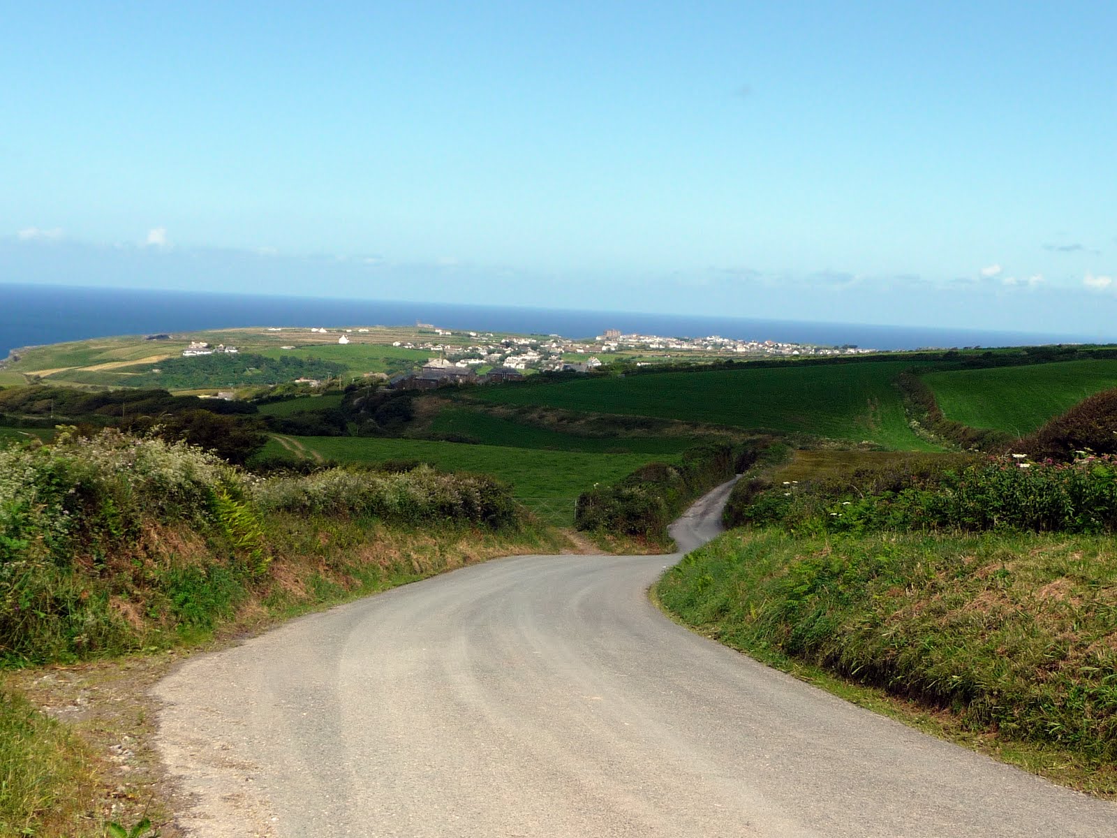
From now on, there were many sharp descents and ascents and I found myself walking as much as cycling.  The gradients were particularly severe into and out of Treknow, but I soon arrived at Tregatta (1250 - 7 miles) and the road to Tintagel remained fairly level from now on.  I made a detour around to the church which was isolated from the village near the edge of a cliff.  This sturdy stone structure which has stood the test of time was the best part of Tintagel.  The rest of the place was a real let down.  King Arthur must have been a real businessman as he had a bookshop, a cafe and an inn all within a short distance of eachother.  His mate, Merlin, wasn't doing too badly either.  There were plenty of Celtic influences and the amusement arcade bore a trifling resemblance to a castle although the mock stones more closely resembled breeze blocks.
I was not amused!

After taking a few pictures, I moved onwards and arrived in Boscastle (1400 - 12.8 miles).  Having enjoyed Boscastle the previous day, I only paused to take a few pictures from the hill as I entered and moved onwards and up a lengthy hill on the B3263.  At Trewannett, I turned left onto a minor passing through the villages of Middle and Higher Beeny which were set in lovely rolling countryside.  Soon, the lane gave way to a green road, but I was horrified to see a very deep puddle almost across the width of the way, thanks to the recent rain.  Fortunately I was able to get past the water and the remainder of my journey along the lane was fairly dry, but only passable on foot.

Near Newton Farm
Soon the road inclined downward and I hurtled into Crackington Haven (1530 - 17.8miles).  This turned out to be something of a disappointment despite the lovely setting - the car park was full and the day trippers seemed to have nothing to do but shuttle between the shop, the ice cream parlour and the pebbly beach.  Prices were extortionate and I was very thirsty - a tiny bottle of water was 75p, so I made it a condition of purchase that they also filled my water bottle from their tap.  They were happy enough to comply.
Crackington Haven

I climbed steeply out of Crackington and joined the coastal lane at Coxford.  meadering left, right, up and down through lovely countryside, I eventually dropped very steeply into Millook.  This place consisted of only a handful of stone houses at the mouth of a very steep valley with rugged cliffs to both sides.  This quiet, inaccessible hamlet was in stark contrast to overcrowded Crackington.
Millook
It was hard going pushing the bike up the very steep hill out of Millook - riding was out of the question.  High up on Budwill point, I had an extensive view to Bude and beyond to the GCHQ establishment further up the coast.  After more ups and downs, I arrived at the holiday village of Widemouth Bay (1650 - 24.2miles).  There was nothing of interest here, so I took no photographs and moved on to the Sea Jade B&B at Bude (1720 - 27.1 miles).
Widemouth Bay, Bude and beyond
In the evening, I popped out for an excellent jacket potato at the town before a good nights sleep.

Monday 30th July - Morwenstow to Bude - 6 Miles

My original intention for this morning was to take a bus to Welcombe Cross, cycle to Welcombe Mouth and travel to Morwenstow over a steep green lane.  Folloing my experience the previous day, I decided that the green lane might be impassable following heavy rain, leaving me stranded and unable to return home at the scheduled time.  This decision means that I shall have to walk the 3 miles between Welcombe Mouth and Morwenstow at some future time.

Instead, I took the 0918 Western greyhound bus, arriving in Morwenstow at 0950.  Morwenstow is a small isolated village comprising a church, an attracive stone pub and a few houses.  The village is set in green grazing coutry and the inclines, in general were much less extreme than experienced on the previous day.
Bush Inn, Morwenstow

Setting off, the most obvious features ahead of me were the white dishes at GCHQ, Bude.  These provided an alien-like intrusion into the landscape and they are certainly visible for many miles around.  The ride progressed steadily until there was a sudden and steep descent into Coombe (1015 - 2.6 miles) and a equally steep climb out of it to the National trust property of Stowe Barton which appeared to house National Trust Offices and was not obviously open to the public.  From Coombe, a minor road runs to the quaintly named "Duckpool" on the coast.  Curiosity did not get the better of me and I did not venture down the lane.
GCHQ from Stowe Barton
There followed a straightforward ride through Stibb to Poughill (1050 - 5 miles)which boasted thatched cottages, sturdy stone houses and a fine church.  Onward through less interesting Flexbury until I reached Bude (1100 - 6.4 miles).
Poughill
I had time to purchase a supply of sandwiches at Sainsburys before making my way to Bude Strand and the bus to Exeter followed by a train home.

Photograph Album

Next Trips


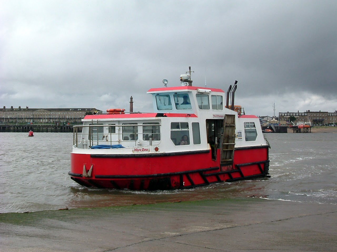
Askam in Furness to Barrow in Furness and Fleetwood Ferry - Saturday 25 August

Folkestone to Dover - Saturday 29 September

Wednesday 1 August 2012

Felixstowe to Hollesley - 30 June 2012 - 11 miles

See the photos


This walk was originally advertised as "Southwold to Aldeburgh", but the threat of cloudy weather made me change my mind.  The four places of interest on the planned walk - Southwold, Walberswick, Dunwich and Aldeburgh all required a sunny day to be seen at their best on what might be my only visit.  I therefore decided to tackle the unwalked stretch of the Suffolk coast from the south.

My journey out was along the well defined route of the 0600 from Birmingham International to Euston, a quick dash along the Circle Line and then the 0800 from Liverpool Street, arriving at Ipswich 10 minutes late by 0917.  From there, a short walk into Ipswich and photographs of what appears to be a city with many attractive features.  Then I boarded the 77 bus at the bus station in the "Old Cattle Market" which took me to Landguard Fort at Felixstowe by 1040.
Ipswich
Languard Fort was originally built by Henry VIII and is the only existing fort to have seen active service, repulsing a raid by the Dutch in 1667. The construction is massive, but it is set so low in the ground that it is virtually impossible to obtain a decent photograph.  Of more interest on that day was a spectacle on the River Orwell between Felixstowe and Harwich.  Around 6 to 8 Thames sailing barges were racing in the harbour.  They made a magnificent sight with their red sails.  Despite the windy weather, they were under what appeared to be full sail and were moving very quickly through the choppy water.
Thames sailing barge at Felixstowe
I enjoyed this event as I made my way to Landguard Point and turned back towards Felixstowe, crunching shingle underfoot as I walked.  I was beginning to panic a little at this point as I had been unable to telephone my wife to report my safe arrival.  I had assumed that there was a temporary fault with the network, but the extreme slowness in restoring normal service began to suggest otherwise.  To complicate matters, two phone boxes I passed were out of order and appeared to have been in the same state for quite a long period of time.  Eventually the obliging proprietor of the first fish and chip shop I came across allowed me to use his phone for the essential call.  If you are ever in Felixstowe please show my gratitude by visiting the establishment!
Help is at hand
There then followed a gentle stroll along the promenade past the unremarkable pier (1145 - 2.7 miles) and the grand houses which became even more grand as I travelled northwards.  At Old Felixstowe, I had to detour inland as work was being carried out on the beach to reinforce the cliff.  I soon regained the cliff which then gradually sloped down to Felixstowe ferry at the mouth of the River Deben.  As I descended, Bawdsey Manor made a spectacular view in its woodland setting across the river.  The Manor was built by Sir William Cuthbert Quilter in 1886, but is most famous for the development of Radar during the Second World War.
Bawdsey Manor
Past a couple of Martello Towers and then a little upstream took me to the Deben Ferry (1255 - 5.8 miles) which was situated near a group of old buildings that would have been picturesque had it not been for the many cars that were parked in front of them.  I found the ferry moored to the jetty, so I wasted no time as we were off just as soon as I was on board.  The fare was the princely sum of £2 for the crossing and I was the only passenger on that crossing.  On reaching the other side, I had to disembark onto the shingle as the North Jetty was out of action for repairs.  Despite this, the transition from boat to land was achieved smoothly.
The Deben Ferry
At Bawdsey Quay I found several substantial building that were probably part of the 19th Century Bawdsey Estate - One house in particular appeared to be a lodge to the manor house seen earlier.  My original plan was to return to the mouth of the Deben on the north bank and walk around the manor along the coast path by the sea.  Since I was feeling a little achy at that time, I took the road to Bawdsey instead.  My decision was confirmed as correct when I came across a "Footpath Closed" notice at the point where the two routes met.  Meanwhile I walked alongside the grounds of the Manor which were attractive despite a number of MOD building in a state of semi-ruin.  When I visited the area about 30 years ago, a number of Bloodhound surface to air missiles were to be seen.  All that now remains are the concrete bases where they were sited.
Bawdsey
I then passed through the village of Bawdsey (1345 - 7.7 miles) which is an attractive sprawl along the B1083.  The sturdy church tower is very large relative to the diminutive nave and the blue clad scaffolding indicated that restoration work was in progress.  The road then led past arable fields to either side into the village of Alderton (1405 - 8.8 miles).  There, I was greeted by a somewhat larger church (without tower), an attractive village sign which has become a common site on my visits to East Anglia and village centre cottages rendered in a delightful range of colours.
All you need to know about Alderton

Outside Alderton, I came across a WW2 bunker by the roadside, a substantial round affair with a steel door.  Moving on, I had a good view of the Shingle Street coastguard houses by the sea.  Finally on the way to Hollesley I was passed by two vintage buses which may have been on their way to the Village Fete.  I saw no sign of activity on the way to my destination at the Shepherd and Dog in the centre of the village (1505 - 11.2 miles), so I determined that the Fete was taking place further on..  I was very pleased to see a sympathetic new development of new houses close to the pub and took the opporunity to inspect the show house.  Thence, I returned for refreshment at The Shepherd and Dog before boarding the bus for Woodbridge.
Hollesley
The bus was small and modern, but disturbingly was adapted to take a significant number of disabled passengers.  However, it was free and efficiently carried me and the only other passenger to Woodbridge.  There was almost an hour wait for the train to Ipswich, so I took myself around the town admiring some of the ancient buildings and unspoiled shopping streets as I went.  It is something of a tourist trap, so I didn't buy any food there, but went back to the station and caught the train which rattled its way back to Ipswich.
Woodbridge.

I had spare time at Ipswich so went in search of food there, but found only a Subway, so I made my way back to the station munching one of their creations before boarding the train to Liverpool Street Station.  On arrival in London, I was delighted to learn that the London Festival was in full swing and one of the highlights was the placement of several pianos in locations around the City available for anyone to play.  The one at Liverpool Street was sounding out to classical music played by a young man.
Liverpool Street Piano
It was soon time to catch the tube train to Euston and the 2103 train which arrived at Birmingham International at 2233.  Thence to the car and home.

See the photos